SICE Journal of Control, Measurement, and System Integration, 2024
Efficient Angle-Aware Coverage Control for Large-Scale Map Reconstruction using Drone Networks
pp. 144–155. Open access.
Part of Angle-Aware Coverage Control for 3D Map Reconstruction
@article{hanif2024angleaware,
  title   = {Efficient Angle-Aware Coverage Control for Large-Scale Map Reconstruction using Drone Networks},
  author  = {Hanif, Muhammad and Shimizu, Takumi and Lu, Zhiyuan and Suenaga, Masaya and Hatanaka, Takeshi},
  journal = {SICE Journal of Control, Measurement, and System Integration},
  volume  = {17},
  number  = {1},
  pages   = {144--155},
  year    = {2024},
  doi     = {10.1080/18824889.2024.2346375}
}
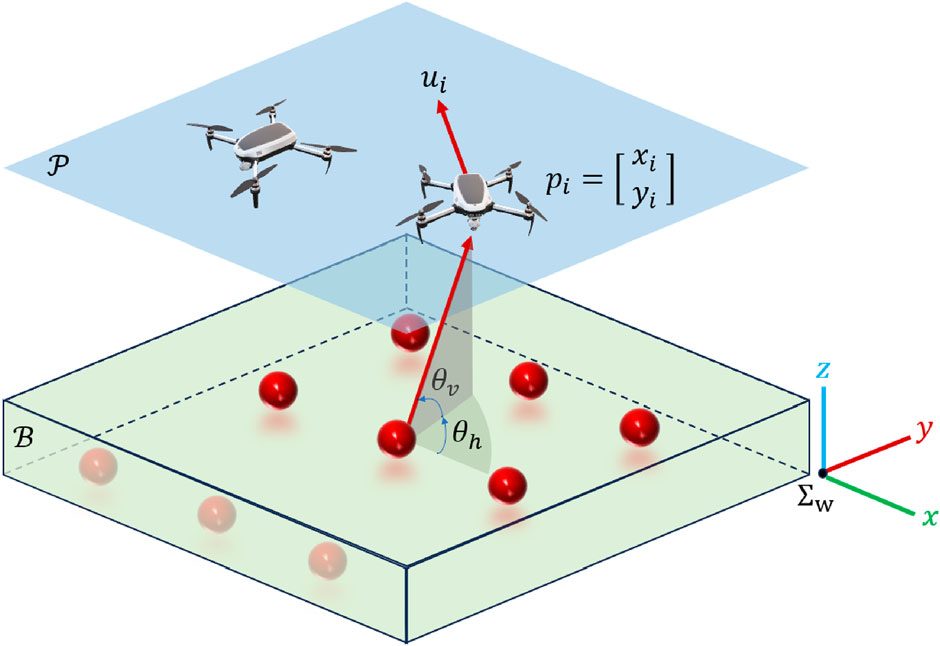
Reconstructing a field in 3D from the air needs images of every point taken from several viewing angles — one angle reconstructs badly, several reconstruct well. Angle-aware coverage control makes that a control problem: the drones fly a five-dimensional virtual field of viewpoints, three spatial dimensions plus the horizontal and vertical angle a point is seen from, and every cell of it carries an importance index that decays as cameras cover it.
The problem this paper fixes
The existing controller has a blind spot on large fields. Because the objective function never evaluates how far away an unobserved point is, distant points carry no more urgency than nearby ones. Small unobserved patches end up scattered across the field, and the drone spends its remaining flight time crossing the field to pick them off one at a time — wasteful in both time and battery. On a small testbed this barely shows. On a large field it dominates.
An obvious fix — writing distance directly into the objective — was tried and failed: the drones stopped exploring and stuck to fixed positions.
The fix
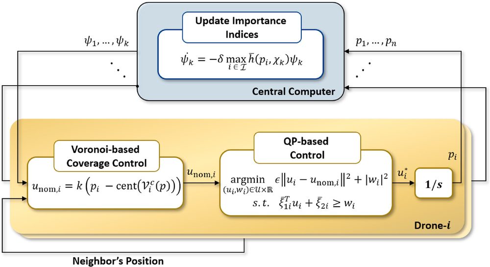
Rather than change the objective, the paper changes the nominal input of the QP. Classical Voronoi coverage supplies a move-to-centroid term that pulls each drone toward the weighted centroid of its own Voronoi cell, so distance enters through where the drone wants to go while the angle-aware constraint on the decay rate of the objective still governs what it is allowed to do.
Results
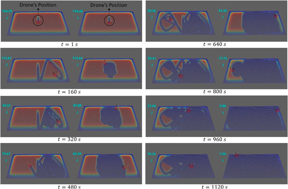
In ROS simulation the difference is consistent:
| Scenario | Previous controller | This controller |
|---|---|---|
| Single drone, large field | J ≈ 0 at ~1300 s | ~900 s |
| Three drones, large field | ~470 s | ~330 s |
| Single drone, physical testbed | ~180 s | ~150 s |
The multi-drone case matters because it answers the obvious objection — that simply adding drones would shrink each drone’s territory enough to hide the problem. It does shrink it, and the advantage holds anyway.
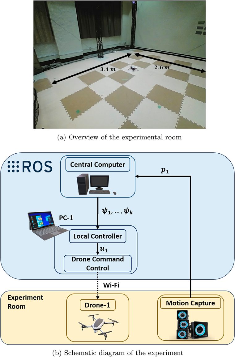
The testbed is only 2.2 m × 2.2 m, so the field was made effectively larger by dropping the drones to 30% of the simulated altitude — narrowing each field of view enough to preserve the ratio between what a drone sees and the size of the field. The gap narrows at that scale, as expected, but it does not close.
Faster completion is also a battery argument, which is the constraint that actually limits these missions in the field.