Angle-Aware Coverage Control for 3D Map Reconstruction
Coverage control that treats viewing angle as part of the state, so a drone team collects the images a 3D reconstruction actually needs — extended to large fields, steerable cameras and battery-limited missions.

A 3D reconstruction is only as good as the images it is built from. A point on a surface seen from one direction reconstructs badly; seen from several, it reconstructs well. So the question for a drone team is not where should we fly but which viewpoints do we still need — and coverage control is a scalable way to answer it.
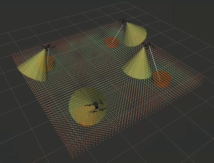
Angle-aware coverage control makes that literal. Instead of covering a 2D plane, the drones cover a five-dimensional virtual field: three spatial coordinates for the point being observed, plus the horizontal and vertical angle it is seen from. Every cell of that field carries an importance index, high while unobserved and decaying as cameras cover it from enough distinct directions. A QP-based controller constrains the decay rate of the resulting objective, so sampling performance is certified rather than hoped for.
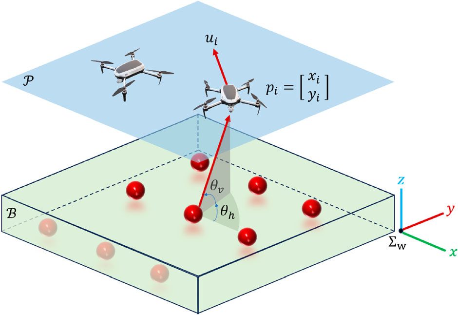
This project is the thread of work extending that idea in three directions.
Making it work on large fields
The original controller has a scaling flaw. Its objective never evaluates how far an unobserved point is, so distant points get no priority, and the field ends up speckled with small unobserved patches that the drone crosses the whole map to collect one at a time. Barely visible on a testbed; dominant on a real site.
The fix was to leave the objective alone and change the nominal input of the QP instead. A classical Voronoi move-to-centroid term pulls each drone toward the weighted centroid of its own cell, so distance enters through where a drone wants to go, while the angle-aware constraint still governs what it may do.
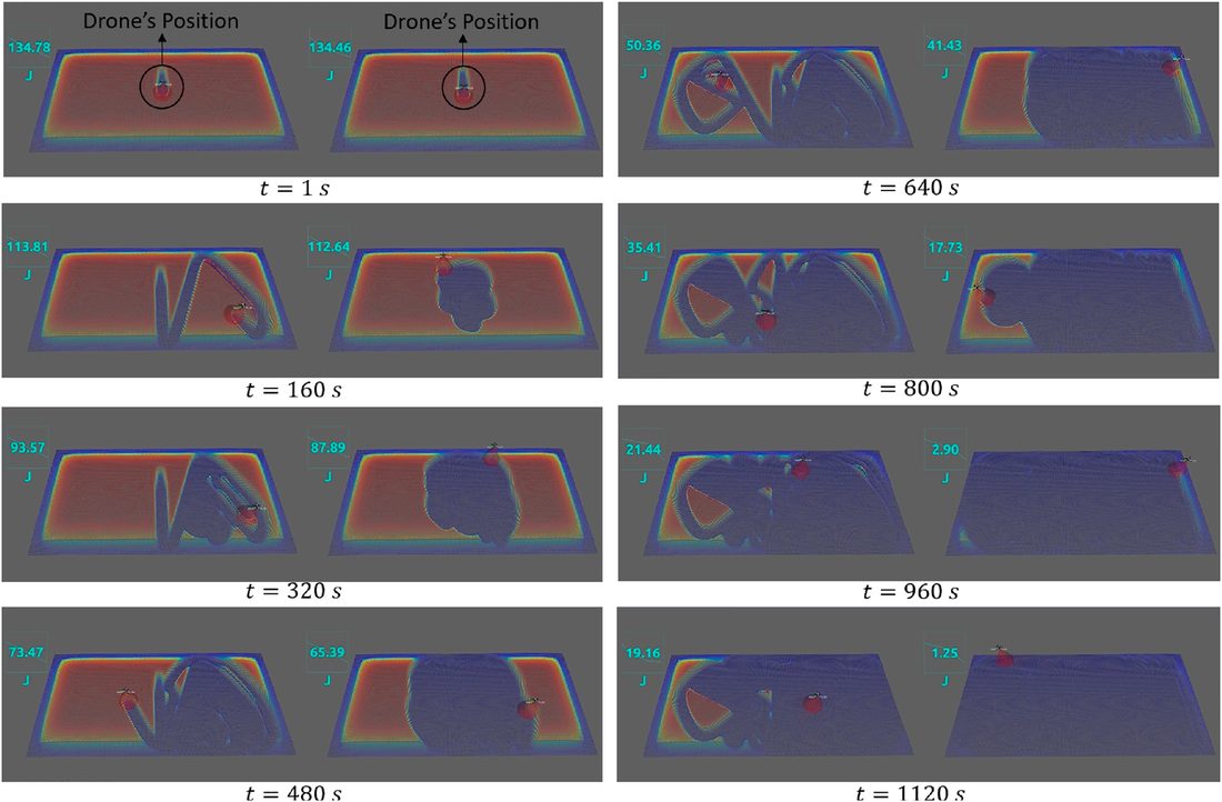
Single drone on a large field: ~1300 s down to ~900 s. Three drones: 470 s down to 330 s. Validated in ROS and flown on the Tokyo Tech Robot Zoo Sky testbed with Parrot Bebop 2 drones under OptiTrack motion capture.
Making the camera move
In the original formulation the cameras point straight down and never move, so the only way to change a viewing angle is to fly somewhere else — leaving the cheapest degree of freedom unused.
Putting the camera on a gimbal and controlling it gives each drone a four-dimensional state: two position coordinates plus two gimbal angles. Covering a point becomes two conditions rather than one — it has to be in frame, and seen from a direction it still needs.
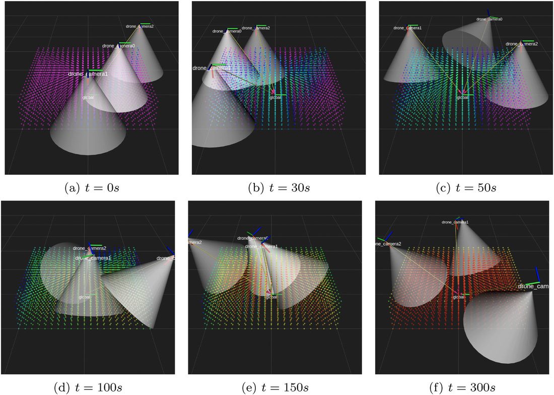
The cost is computational. With a steerable camera the 5D field no longer collapses onto a 2D one, so the full problem has to be solved directly. JAX, with JIT compilation and GPU acceleration, brought the per-step time from 1206 ms to 22 ms — the difference between an idea and a controller.
Making the mission persist
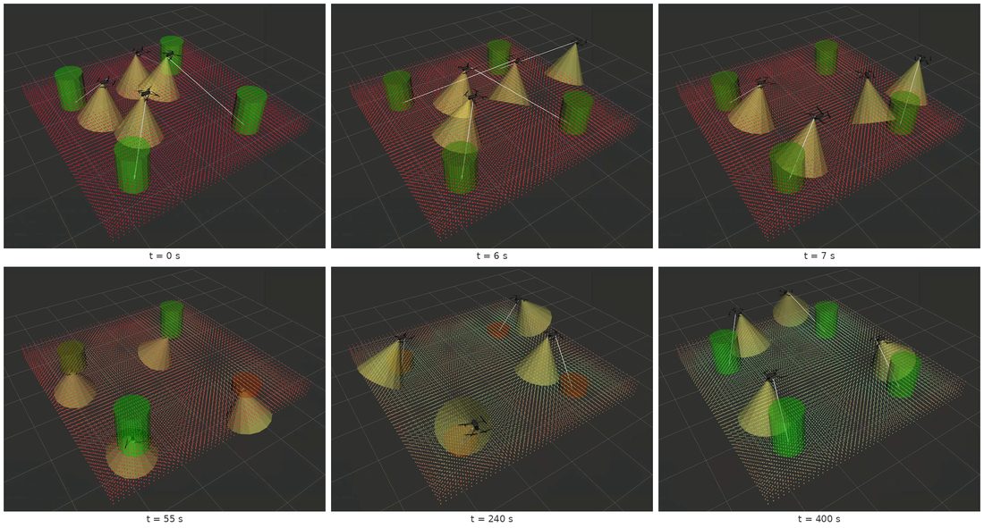
A field worth reconstructing takes longer to cover than a battery lasts, so charging belongs inside the control problem. Fixing which station each drone returns to wastes the flight time the constraint was meant to protect; assigning stations dynamically through ADMM does not.
Where it goes next
The natural continuation is closing the loop with the reconstruction itself — using the evolving 3D map as a feedback signal to tell the fleet where it is still unresolved. That became a separate project: Multi-Drone Image Sampling with Online Map Feedback.
Applications
Precision agriculture and crop inspection, rapid mapping of disaster zones, construction-site progress monitoring, and urban infrastructure survey — anywhere the reconstruction has to be good enough to measure from, not just to look at.
Video
Publications from this project

Ph.D. Dissertation, Institute of Science Tokyo, 2025
Multi-Drone Coordinated Image Sampling for 3D Map Reconstruction through Efficient and Scene-Adaptive Coverage Control
Department of Systems and Control Engineering. Advisor: Prof. Takeshi Hatanaka.
SICE Journal of Control, Measurement, and System Integration, 2024
Efficient Angle-Aware Coverage Control for Large-Scale Map Reconstruction using Drone Networks
pp. 144–155. Open access.
@article{hanif2024angleaware,
  title   = {Efficient Angle-Aware Coverage Control for Large-Scale Map Reconstruction using Drone Networks},
  author  = {Hanif, Muhammad and Shimizu, Takumi and Lu, Zhiyuan and Suenaga, Masaya and Hatanaka, Takeshi},
  journal = {SICE Journal of Control, Measurement, and System Integration},
  volume  = {17},
  number  = {1},
  pages   = {144--155},
  year    = {2024},
  doi     = {10.1080/18824889.2024.2346375}
}
SICE Journal of Control, Measurement, and System Integration, 2024
Angle-Aware Coverage with Camera Rotational Motion Control
pp. 211–221. Open access. Preprint arXiv:2404.13915.
@article{lu2024anglewarecamera,
  title   = {Angle-Aware Coverage with Camera Rotational Motion Control},
  author  = {Lu, Zhiyuan and Hanif, Muhammad and Shimizu, Takumi and Hatanaka, Takeshi},
  journal = {SICE Journal of Control, Measurement, and System Integration},
  volume  = {17},
  number  = {1},
  pages   = {211--221},
  year    = {2024},
  doi     = {10.1080/18824889.2024.2351637}
}
SICE Annual Conference, 2024
Angle-Aware Full 3D Coverage Control with ADMM-based Dynamic Assignment of Charging Stations
pp. 1119–1124.
@inproceedings{lu2024admm,
  title     = {Angle-Aware Full 3D Coverage Control with ADMM-based Dynamic Assignment of Charging Stations},
  author    = {Lu, Zhiyuan and Hanif, Muhammad and Hatanaka, Takeshi},
  booktitle = {Proceedings of the SICE Annual Conference},
  pages     = {1119--1124},
  year      = {2024}
}